Inches below the murky water my toes are invisible. The Green Rivers’ flow is incomparable to the Mexican streams I  bathed in days ago. My first encounter with the waters of Utah is stark. To be honest, I think they may be polluted.
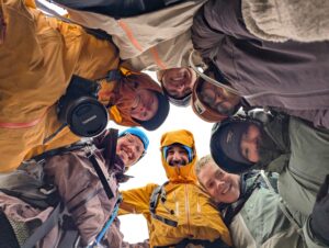
On March 26th 2015 a group of seven are deposited at the end of Angel Point Road. To our west the ivory-capped Henry Mountains shrink as we descend into canyon country. Soon barren Navajo Sandstone is rolling, dipping, cascading. Homogenous granules hold traction with our boots as we scale deep billows. 200 million years ago the largest sand dune desert known to Earth would have been shape shifting all around us.
My internal dialogue is outwardly spoken by others- have we just stepped foot on Mars? Irony lingers on this question mark. The Colorado Plateau is far from celestial. There may be no better place to greet Earth. We have just embarked on a journey into something much more foreign than rock… time.
After 820’ of elevation loss, we arrive to the bottom of the canyon. Here the Dirty Devil River flows the color of milk chocolate, reminding us of our temporarily forgotten hunger. Setting down our 50+ lb. packs, we untie our bootlaces and slide into more appropriate river crossing attire- sands with socks. Twenty-five feet across and primarily ankle deep, our main concern is mucky silt. You may have heard of what we fear- quicksand.
We cross with ease.
Our next obstacle is securing drinking water. The next two evenings we slumber in Angel Cove. On the rear surface of this amphitheater-shaped alcove warps a moist horizontal layer. Rather porous, Navajo Sandstone is frequently inundated by water percolating downwards. Upon hitting an impermeable layer (called an aquiclude), water flows horizontally to the outer margins. Overtime this process, called groundwater sapping, creates alcoves. Springs often form at their base, as found in Angel Cove. Lo and behold, a clear water source.
As we head downriver for the next nine days our bodies and minds become accustomed to Dirty Devil travel. We learn to read the landscape for places to avoid, or at least not follow those who seem destined to find the deep and sticky spots. Side canyons offer pools in dwindling streambeds. The potential forty-five minutes walk to these liquid dwellings provides space for reflection. One of our instructors, Katie Nelson, humbly reminds how many women around the world travel further each day to gather adequate water.
A walk through cool flow becomes a blessing.
For a day and a half we diverge from the river. Shinarump Conglomerate creates a flat terrace above riparian communities. Along these elevated passages new perspectives are offered. One area particularly brings us to our knees. Round river pebbles anchor themselves to seemingly flowing ground. Some stones loosen themselves. We hold them between our fingers.
They feel old. They are old, carried here from a Paleozoic mountain range no longer in existence. We stand on ancient riverbed much older than the Dirty Devil below.
Even here the presence of flow is inescapable.
Moving through the land of rise and fall, growth and decay, even destruction creates. The layers we meander through tell a story, from the Permian period 286 million years ago to present. Each grain our eyes touch has been shaped by water. Each membrane our hands caress has been kissed by this force.
The rivers here are not as polluted as I initially thought. Water is of milk chocolate because sand particles are being transported. At times they are deposited into our water bottles. Their bodies course through our own, an interaction more than appropriate.
These canyons are breathing, revealing the wonders of life. My hope is you look past this screen and become witness to the beauty around you.
What is the story of your place?